BGC’s early action to support the response efforts in British Columbia for the November 2021 flooding
ARISE Canada Member Content
Matthew Lato, Ph.D. Eng. (AB, BC, ON, SK). | March 25, 2022
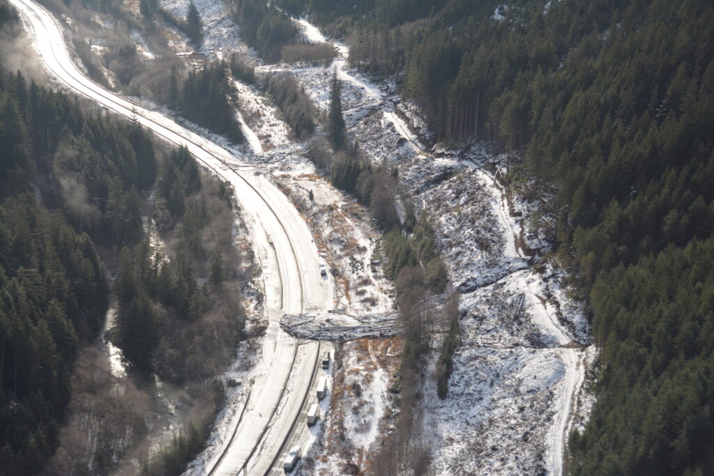
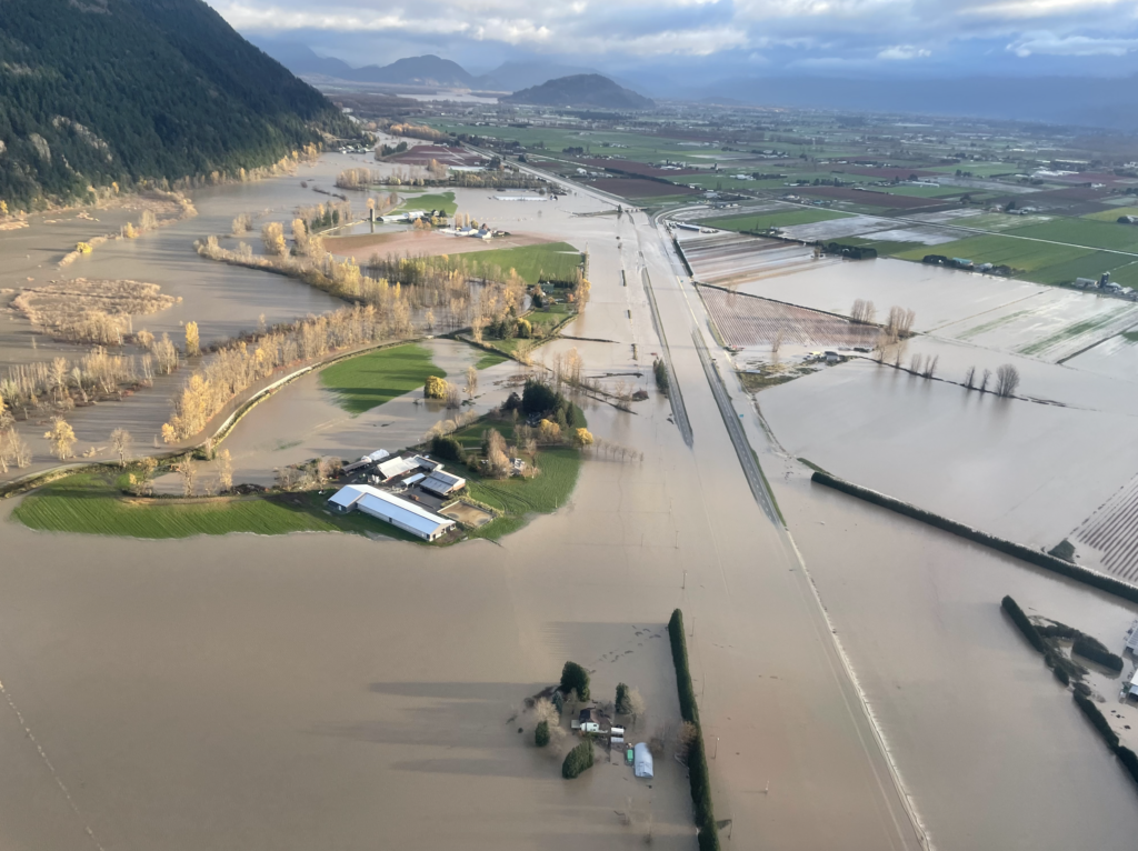
In November of 2021, southwestern British Columbia, Canada and northwestern Washington State were affected by a series of atmospheric rivers that caused widespread geohazards and destruction of critical infrastructure. This weather event resulted in massive precipitation leading to flooding, landslides, and debris slides that impacted many communities. Highways, pipelines, energy transmission lines, and railways all experienced damage and were inoperable – the severing of these arteries effectively cut off one of the biggest populations in Canada from the rest of the country. At the date of writing, some of these critical infrastructures are still out of commission.
In the immediate aftermath of the event, BGC worked collaboratively with our clients to develop an understanding of the damage and chart a path to recovery. Within hours of the event, BGC staff headed out to the field to assess the situation from the air for clients across pipeline, transportation, railway, and community sectors. Field staff were supported by office teams across various disciplines, including Surface Water, Geohazards, GIS, Software, Data Science, and Earth Observation teams. The field staff relayed information and images back to the BGCers in the office, allowing the team to work side-by-side with our clients to understand the impacts of the flooding and precipitation and to help prioritize emergency mitigation efforts.
BGC deployed various technologies to assist in data collection and assessment of the impact. During the immediate response we utilized UAV and helicopter photos to generate 3D models of high priority impacted sites. The models were generated within hours of photo collection and deployed to field and office teams within BGC and with our clients.
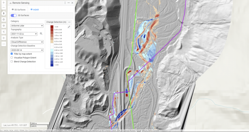
Another technique utilized was regional scale three-dimensional lidar change detection. Numerical processing can be used to quickly identify and visualize areas of topographic change where multiple lidar datasets are available for the same areas. In the case of the British Columbia atmospheric river events, BGC used airborne lidar scanning change detection to find and quantify the resulting geohazard activity, which took the form of landslides, flooding, bank erosion, and debris slides.
Working closely with our partners at McElhanney, we collected over 500 square kilometres of airborne lidar scanning data between Hope, BC and Merritt, BC. The post-atmospheric rivers data was compared to earlier datasets available from prior work for clients in the area. BGC was able to deliver digital change detection results within hours of receiving the lidar data from McElhanney using our patent processing method (patent has been allowed and is currently in the process of being granted). Results were immediately available to our clients and their partners through Cambio, our secure online platform, to support in recovery efforts. The resulting data was used to identify impacts on assets, prioritize field inspections, develop new designs, and understand future risks.
In the past year we have processed over 50,000 square kilometres of lidar change detection data, serving up tens of billions of lidar change detection points in Cambio to clients globally. We are proud that this work has been able to rapidly deliver high-value information used to protect life, reduce costs, and protect the environment.